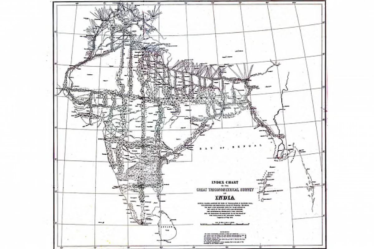
In the early 19th century, a monumental scientific project began that would leave a profound mark on the Indian subcontinent. The Great Trigonometrical Survey of India, initiated in 1802, was not merely about cartography; it was a groundbreaking venture that reshaped the landscape of India through precision, innovation, and vision. Spearheaded by British infantry officer William Lambton under the East India Company, this survey transformed the understanding of the subcontinent’s geography and had far-reaching impacts on administration, economy and cultural heritage. The Great Trigonometrical Survey officially commenced on 10 April 1802, with the measurement of a crucial baseline near Madras (now Chennai). Major Lambton, who was tasked with leading this ambitious project, carefully selected a flat plain for the initial measurement.
The baseline stretched 7.5 miles (12.1 km) and was marked by St. Thomas Mount at the north and Perumbauk Hill at the southern end. This baseline was the first step in a meticulous process that aimed to map the vast Indian subcontinent with unprecedented accuracy. Lambton’s choice of a flat plain for the initial baseline was strategic. Accurate measurements were crucial for the success of the survey, and a flat, unobstructed baseline allowed for more precise calculations. The work began with the meticulous measurement of this baseline, which would serve as the foundation for the extensive triangulation network that followed. The Great Trigonometrical Survey utilized advanced trigonometric techniques to measure distances and angles across the vast expanse of India.
Advertisement
The method involved creating a network of triangles, using the baseline measurements as a reference point. By measuring angles and distances within these triangles, surveyors were able to map the terrain with remarkable precision. One of the most notable achievements of the survey was the accurate measurement of the meridian arc from the southern tip of India to Nepal. This endeavour required surveying through varied and challenging terrain, including the Himalayan mountain range. The precision achieved in this measurement allowed for the calculation of the Earth’s circumference with astonishing accuracy and contributed to global scientific knowledge. For the British East India Company, the survey was more than a scientific undertaking; it was a crucial tool for effective administration and control. The detailed maps produced by the survey enabled the British to manage the vast and diverse regions of India with greater efficiency.
Accurate geographical information facilitated better planning of infrastructure projects such as roads, railways, and irrigation systems. The survey’s precise maps were instrumental in the collection of land revenue, as they provided detailed information about land use and boundaries. This information was crucial for implementing administrative policies and managing the economic resources of the subcontinent. The improved accuracy in mapping also played a key role in the strategic planning of military campaigns and the consolidation of British rule across India. The detailed maps created by the Great Trigonometrical Survey had a transformative effect on the Indian economy. The accurate depiction of geographical features facilitated the construction of infrastructure that was vital for economic development.
Railways, roads, and irrigation systems were planned and executed with greater precision, fostering economic growth and integration. The expansion of the railway network, for instance, connected previously isolated regions, facilitating trade and commerce. This connectivity helped create a unified market across the subcontinent, stimulating economic activity and development. The survey’s work in mapping resources and land use patterns also contributed to the optimization of agricultural practices and resource extraction, further boosting economic growth. Beyond its immediate practical benefits, the Great Trigonometrical Survey left a lasting legacy in the fields of science and culture. The survey’s precision and methodology advanced the science of geodesy and set new standards for geographic measurement. The accurate geographic coordinates established by the survey influenced future scientific research and exploration. Culturally, the survey contributed to a deeper understanding of India’s diverse geography and historical landmarks. By documenting and mapping ancient sites and natural features, the survey helped preserve India’s cultural heritage.
The detailed maps provided insights into the region’s historical and cultural landscape, enriching the appreciation of India’s heritage. The significance of the Great Trigonometrical Survey is commemorated by several memorials across India. One notable example is Lambton’s Memorial in the village of Perumbauk, which marks the site where the initial baseline measurement began. These memorials serve as a testament to the monumental effort and achievements of the survey, honouring the contributions of Major Lambton and his team. The Great Trigonometrical Survey of India was a landmark project that reshaped the Indian subcontinent in multiple dimensions.
From its meticulous beginning with the measurement of a 7.5-mile baseline near Madras to its profound impacts on administration, economy, and culture, the survey was a transformative endeavour. Its legacy endures through the precise maps it produced, the infrastructure it helped develop, and the scientific advancements it inspired. The Great Trigonometrical Survey stands as a testament to the power of scientific innovation in shaping the course of history and transforming societies.
(The writer is Associate Professor, Centre for South Asian Studies, Pondicherry Central University.)