Quake jolts Delhi-NCR: Authorities keeping close watch, says PM
An earthquake measuring 4.0 on the Richter scale struck Delhi-NCR in the early hours of Monday, triggering panic among residents.
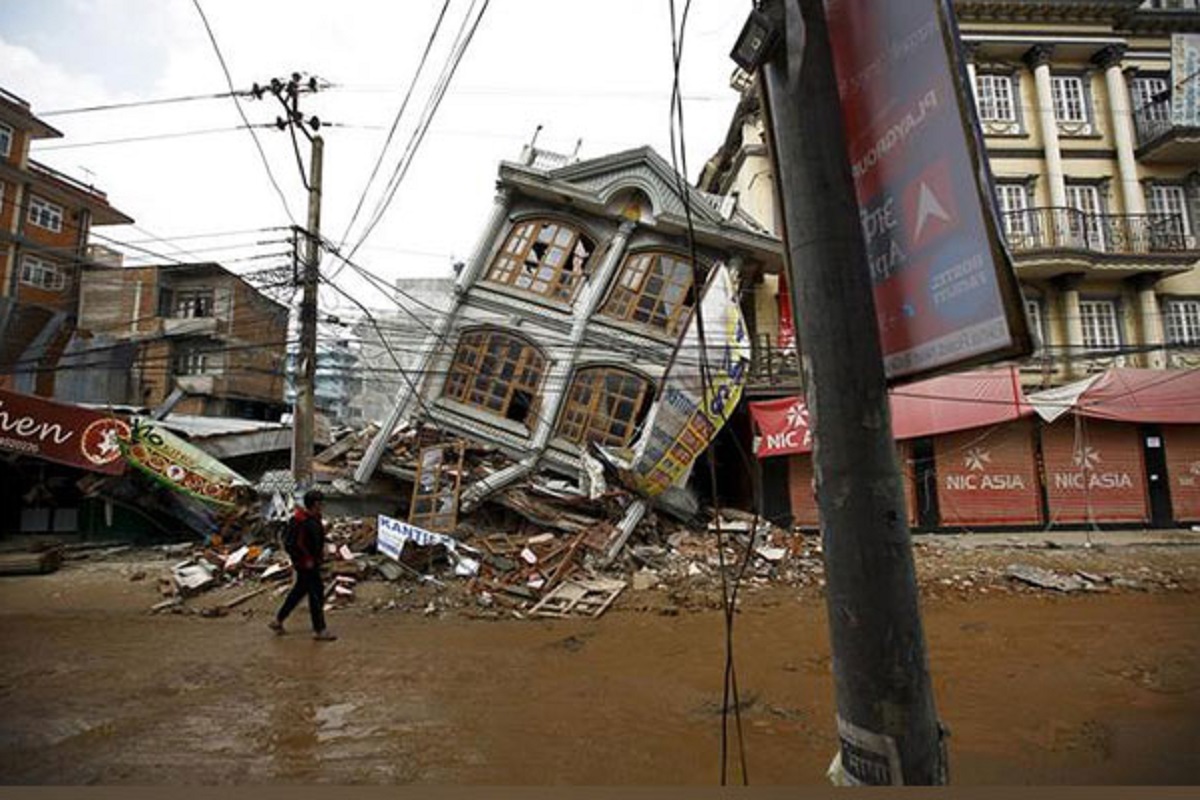
At least 125 people were killed and dozens left wounded after Friday’s earthquake in Nepal that brought back the memories of April 2015 when thousands of people were killed after a devastating quake hit Gorkha district of the Himalayan nation.

ANI Photo of a building that was destroyed in the Nepal earthquake
At least eight earthquake ranging from minor to strong intensity have struck Nepal in the last 24 hours with strongest one of magnitude 6.4 on Friday at 11.32 pm, according to the National Centre for Seismology (NCS), Ministry of Earth Sciences, Government of India. Multiple earthquakes also hit Myanmar, Afghanistan and Manipur in India, albeit of low intensity.
All these places are located in the fault lines of the Indian and the Eurasian tectonic plates. The increased earthquakes along the India-Eurasia tectonic plates have been troubling seismologists, according to whom, the Indian plate is driving into Eurasia at a rate of approximately 47 mm/year.
Advertisement
After the Friday’s 6.4 earthquake, Nepal witnessed another 4.1 magnitude quake in less than 25 minutes, following by at least six more over the next few hours into Saturday. During the same period, A small intensity earthquake struck Manipur’s Tamenglong and Kangpokpi. A 3.5 magnitude quake also struck Ayodhya in Uttar Pradesh earlier today.
Advertisement
A medium intensity earthquake of magnitude 3.8 also hit Myanmar some two hours after the Nepal quake. A 3.9 magnitude earthquake also Afghanistan that also falls in the same Indiana and Eurasian tectonic plates.
At least 125 people were killed and dozens left wounded after Friday’s 6.4 magnitude earthquake in Nepal that brought back the memories of April 2015 when thousands of people were killed after a devastating quake hit Gorkha district of the Himalayan nation.
The reason why Nepal and its surrounding northeast India region face earthquakes so frequently is that there is a huge fault line characterized by the Indian tectonic plate sliding under the Eurasian plate, forcing the latter upwards and causing drastic shaking of the region.
Understanding the Indian-Eurasian tectonic plates
According to the USGS, the Himalayan mountain range dramatically demonstrates one of the most visible and spectacular consequences of plate tectonics. When two continents meet head-on, neither is subducted because the continental rocks are relatively light and, like two colliding icebergs, resist downward motion. Instead, the crust tends to buckle and be pushed upward or sideways.
“The collision of India into Asia 50 million years ago caused the Indian and Eurasian Plates to crumple up along the collision zone. After the collision, the slow continuous convergence of these two plates over millions of years pushed up the Himalayas and the Tibetan Plateau to their present heights, the USGS says.
“Most of this growth occurred during the past 10 million years. The Himalayas, towering as high as 8,854 m above sea level, form the highest continental mountains in the world. Moreover, the neighboring Tibetan Plateau, at an average elevation of about 4,600 m, is higher than all the peaks in the Alps except for Mont Blanc and Monte Rosa, and is well above the summits of most mountains in the United States.
Advertisement